
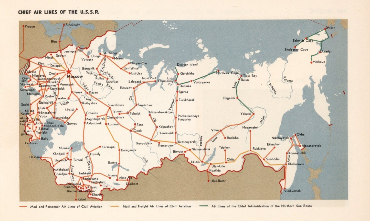
There’s a tiny error on this map. Made around the time of the New York World’s Fair in 1939, it shows the airports and air routes of the Soviet Union at a time when the USSR was keen to show visitors a country stitched together by aeroplanes. Follow the lines north until they run out and you arrive at a dot near the mouth of the Yenisei, labelled Dickson. But in 1939, it should ~ of course ~ be marked ‘Dikson’.
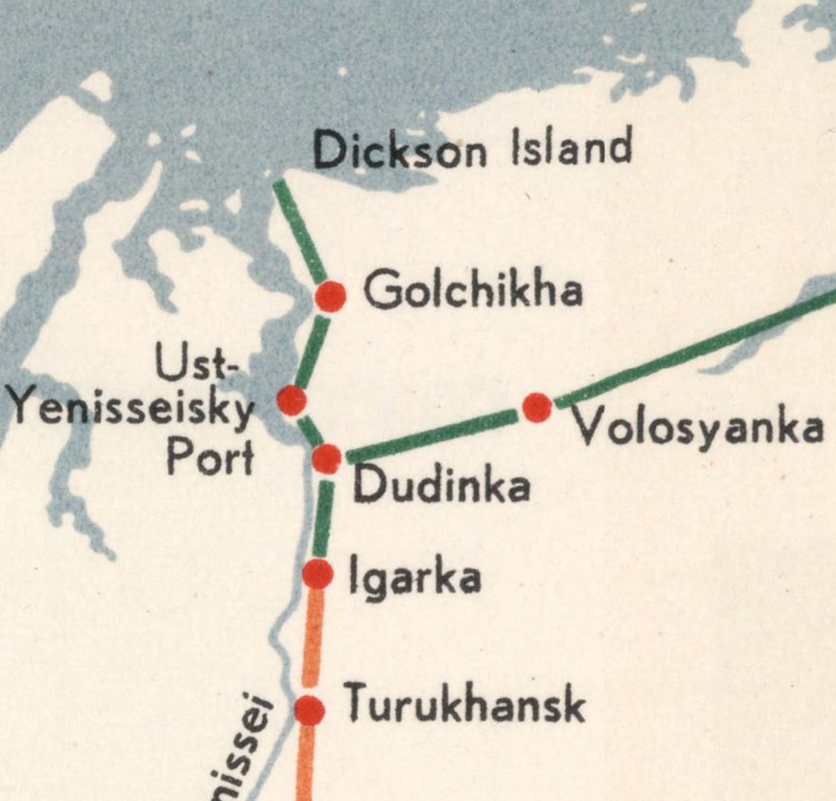
Adolf Erik Nordenskiöld named the harbour in 1875 after Oscar Dickson, a merchant from Gothenburg who’d paid for his foray north. Russian usage dropped the ‘c’ almost at once, and Dikson has been the official name since 1884 ~ which means on the day it was printed, this map was fifty-five years behind the curve.
You’ll have spotted this is an air map: Dikson is still the northernmost airstrip on any continental mainland, and from 8 December to 5 January it gets no daylight at all, not even twilight ~ but that’s almost a moot point.
I’m about to describe a fight between a cruiser, an icebreaker and two guns parked on a pier. The only aeroplane in what follows is a German floatplane, and even that gets wrecked before the shooting starts ~ but I liked the map, and I’ve been posting notes and tweets and whatever-it-is-bluesky does about Soviet mapping today, so this is the map you’re getting. It’s that little red dot, that deserves our attention.
In August 1942, Dikson was the scene of what is usually described as the only battle fought against German forces beyond the Urals. The Germans arrived by sea, certain they could take the land base without too much trouble, and they left, having been put firmly in their place – and without putting a man ashore.
BREAKING THE ICE
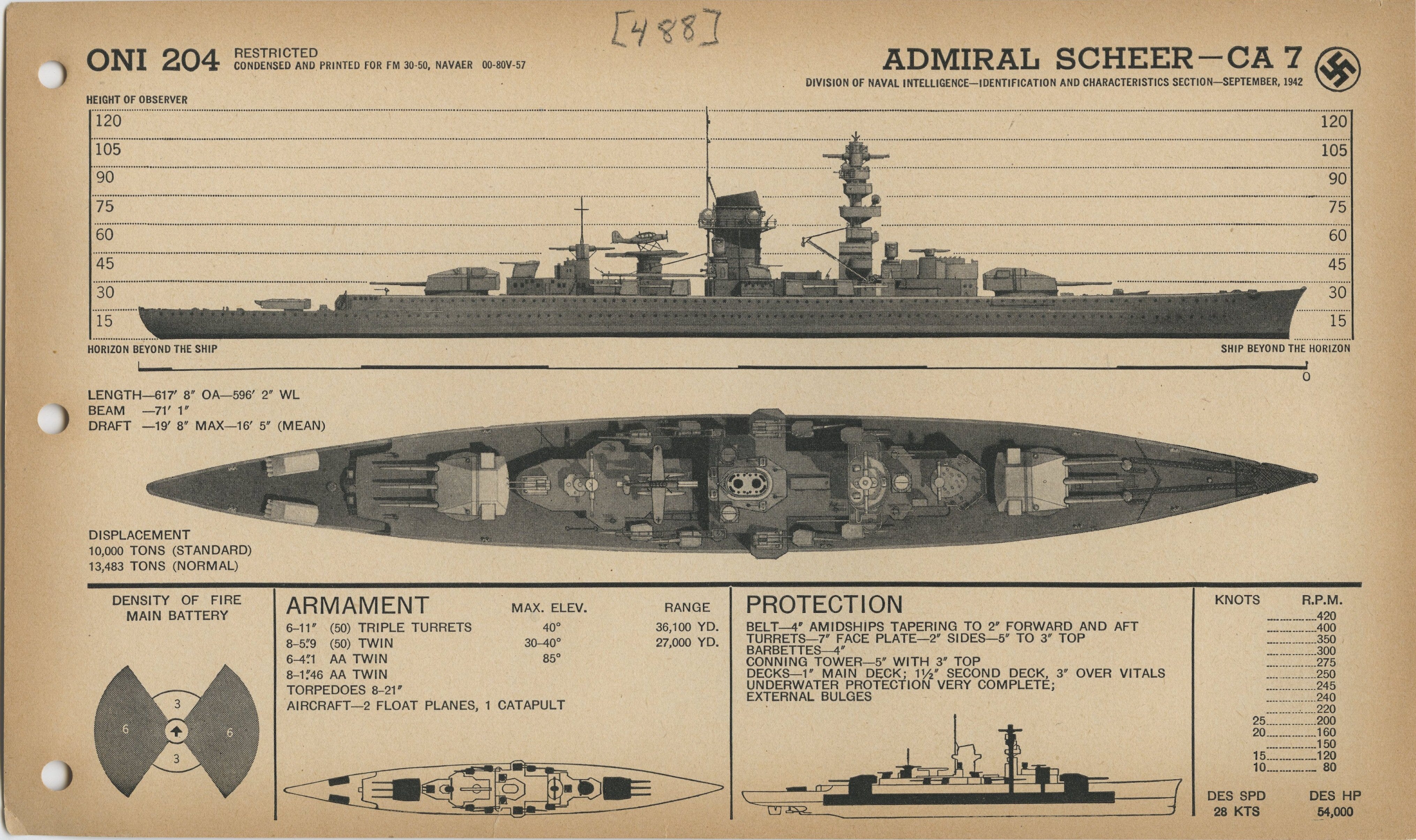
The German heavy cruiser Admiral Scheer left Narvik on 16 August 1942 for the Kara Sea. As one part of Unternehmen WUNDERLAND, her task was to find and sink the convoys using the Northern Sea Route along the Siberian coast.
Operation WONDERLAND was considered a first, key stage in establishing control over the western Arctic. As is often the way, Mother Nature didn’t attend the same briefings. Pack ice turned the Admiral Scheer back from the Vilkitsky Strait, fog hid the convoys her floatplane had found, and then the floatplane itself was lost in what might be called a ‘landing accident’. Her captain, Wilhelm Meendsen-Bohlken, also discovered his charts could not be trusted. Rocks stood where open water was marked, and shoals where the chart promised depth.
Maps, huh.
But then on 25 August, her lookouts sighted a single ship, the Alexander Sibiryakov, a Glasgow-built steamer of 1909 that had started life hunting seals off Newfoundland.
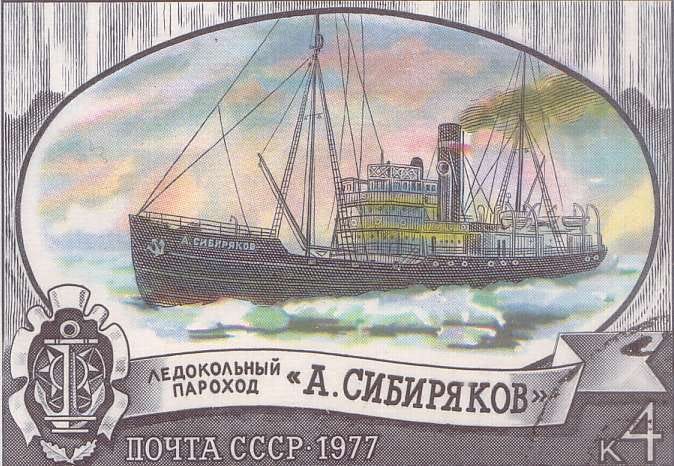
In 1932 the Alexander Sibiryakov had made the first single-season passage of the Northern Sea Route, finishing it under improvised sails after losing her propeller. The Soviet Navy had requisitioned her in September 1941 and given her a handful of light guns – which is something of a coincidence.
Alexander Sibiryakov, the Siberian gold merchant she was named for, had been Oscar Dickson’s partner in funding Nordenskiöld. Sixty-odd years later, one patron’s ship was about to die warning the other patron’s island. She carried six 11-inch guns and a crew of 1,150 ~ it wasn’t enough.
Meendsen-Bohlken wanted the Alexander Sibiryakov intact. Her codebooks and ice reports would tell him where the convoys were. He ordered her – presumably in signals of one syllable ~ to strike her flag, and Captain Anatoli Kacharava gave his answer with a plain-speaking message from his deck guns. Not the best idea, when face to face with the Admiral Scheer, which promptly responded with the few salvoes needed to set the Alexander Sibiryakov on fire. Her crew opened the seacocks so that nothing useful could be salvaged, and most of the 104 people aboard died – but not before they had radioed the nearest military base, with a report on what was happening, and where. Within hours every Soviet ship and station in the Kara Sea knew that a German raider was loose, and the busiest transmitter of all was at Dikson.
BREAKING OUT THE BIG GUNS
With surprise gone and the convoys out of reach, the Admiral Scheer turned south for Dikson. With a radio station, a coal depot, and offices full of ice data – explaining where a ship might sail its cargo of military supplies to meet men travelling overland – Dikson was the headquarters of the western end of the sea route. Meendsen-Bohlken readied a landing party of 180 men -- his intelligence said the garrison was manned by no more than sixty or so frontier guards, bored and bearing little in the way of arms or a credible defence.
His intelligence was nearly right. Dikson’s coastal batteries had just been dismantled for transfer to Novaya Zemlya. Two elderly 152 mm siege guns were sitting on the pier waiting to be loaded. When the warning came, their ammunition was hauled back off the barge and about 300 militia turned out with rifles and hunting guns.
Lookouts sighted the Admiral Scheer at 1.05 a.m. on 27 August. An icebreaker, the Semyon Dezhnev, steamed out to meet her but was holed within minutes, with seven of her crew killed. The steamer Revolutsioner was hit three times and left burning. A third ship, the Kara, sat behind the smoke with several hundred tons of explosives in her holds and was never touched — but then the pier opened fire.
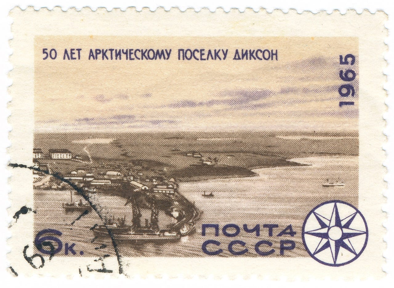
The two guns had no proper emplacements, so each shot sent them rolling backwards. A lorry had to drag them into position again until someone wedged the trails with logs. Crews could barely see their target through the smoke, and as far as anyone can prove, they hit absolutely nothing. What they did do though, was put tall columns of water beside a ship whose captain had been told to expect rifles and relatively little in the way of a defence. The words, ‘cor blimey’ don’t cover it.
Meendsen-Bohlken made smoke and withdrew, circling the island, shelling Dikson’s radio station, its power plant, and the fuel stores. By the time he broke off, he’d used about a fifth of his ammunition ~ his landing party never left the ship.
Admiral Scheer was back in Norway by 30 August, her captain believing he’d wrecked the port. Both damaged Soviet ships were back in service within a week. Meendsen-Bohlken had steered for Dikson with a picture in his head of sixty men with rifles, and that picture was about as current as the spelling on that first map.
It’s almost an addendum, but...
I’m reminded that in his book, Farthest North, Fridtjof Nansen sailed past Dikson on his way east, and pointed out the Taymyr coast disagreed with every map he had.
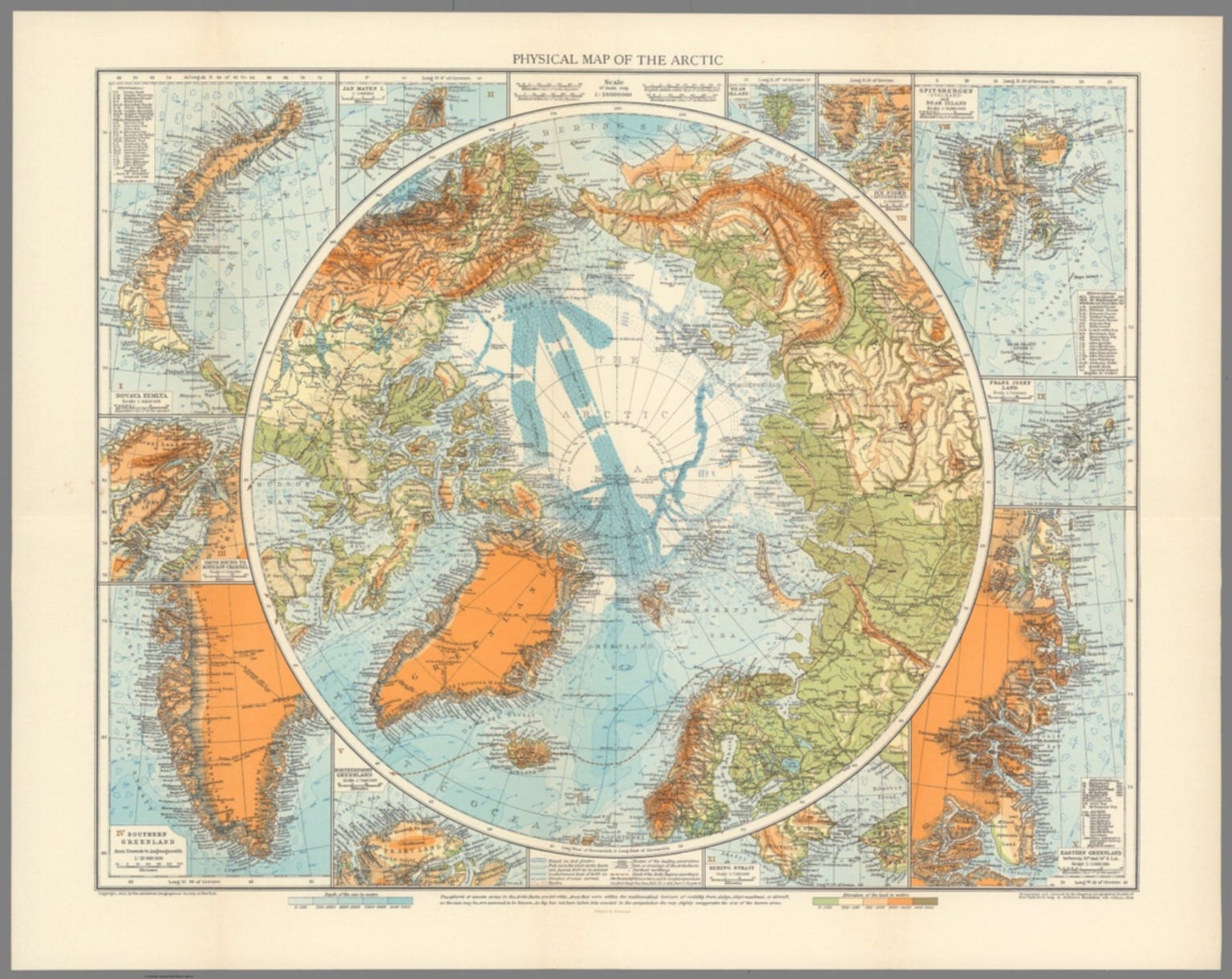
This second map shows how thinly the northermost edge of the Soviet Union was charted at the time. Those are awfully straight lines. Look:
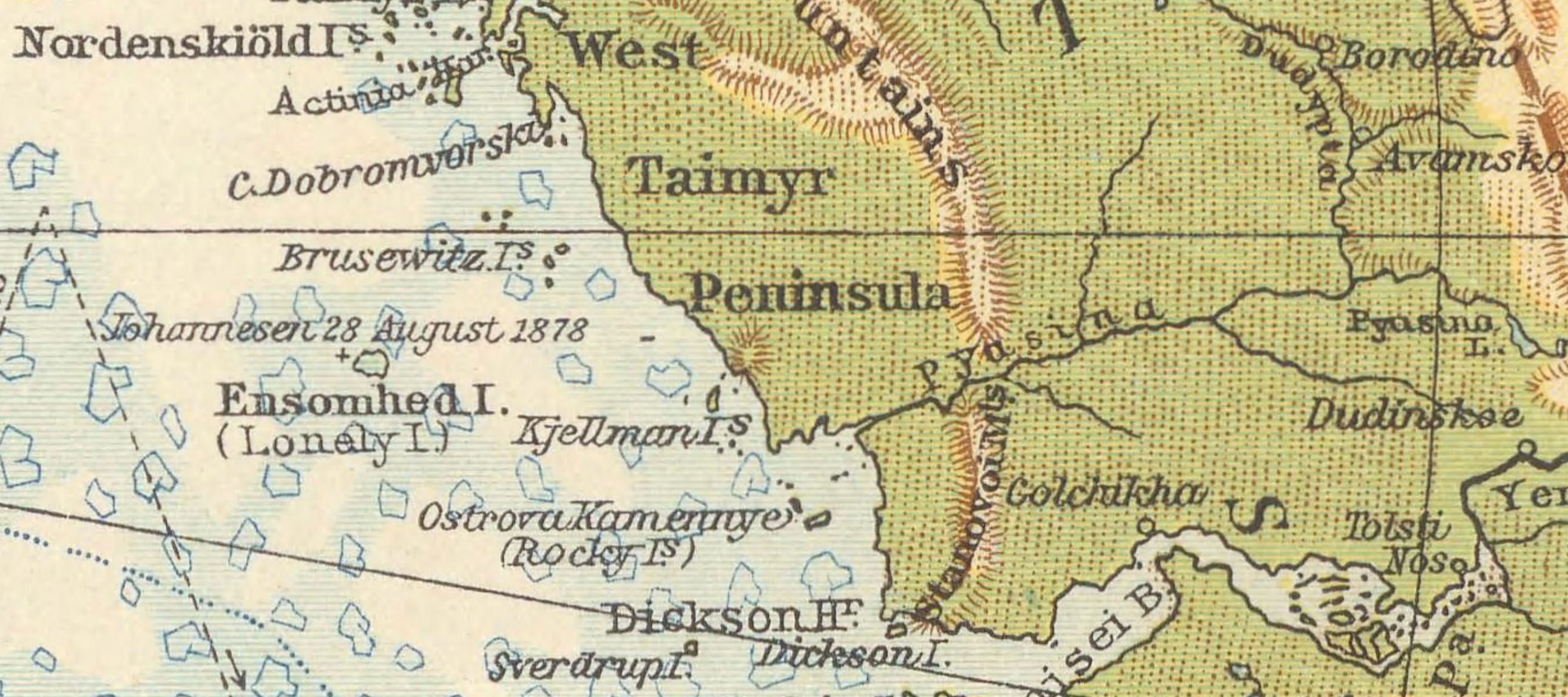
It’s true, the Kriegsmarine had better material than most, including photographs taken from the airship Graf Zeppelin on her polar flight of 1931. But that still left a heavy cruiser feeling her way along a coastline that bore little resemblance to reality, and between rocks not on any chart. Let’s go back to the first map.
Confident lines suggest a sea-margin well mapped. Bold lines also suggest a country well served from the air, right up to its northern edge. At Dikson, in 1942, that line ended at a barely serviceable airstrip, and little more than a wireless mast, and a coal heap. One starts to wonder, what kind of desperate conversations, maps and charts prompted Unternehmen WUNDERLAND at all.