
Royal Mail has just unveiled a series of Remembrance stamps. Six of them, painted by Matthew Cook, in a palette that takes its inspiration from the poppy. No maps, which is fine, but a good excuse to talk about maps and stamps.
Ackshually, they’re not unusual. Nor are the people who collect them. I won’t bore you with the also-rans, of which there are many, many, many examples. But I will mention a few specific map-stamps, all of which have been less than subtle. First the blatant, in-your-face, we’re-making-a-point-here-folks stamp: Venezuela ~ in the middle of a boundary row with London ~ which issued a stamp in 1896 to show a map labelling a large part of British Guiana as Venezuelan. Forgeries are common, though I won’t bore you with those map details, either. Not yet, anyway.
Two years later, Canada issued an Imperial Penny Postage stamp showing the world under a Mercator projection, Empire picked out in red. Canada sat front and centre over a line of jubilee verse: We Hold a Vaster Empire Than Has Been. Mercator makes the northern part of any empire look huge, which I doubt anyone in Ottawa minded. But let’s get back to the Second World War.

THE STAMP-COLLECTING PRESIDENT
It’s fairly well known that stamp collectors may count President Franklin Delano Roosevelt among their number. He started collecting at eight, when his mother handed her own collection over, and never really stopped. Owing his life, he said, to his hobbies, he kept at the albums through polio and throughout the war, sitting down with them most days even while he was running it. FDR credited stamps with teaching him geography, and I believe him.
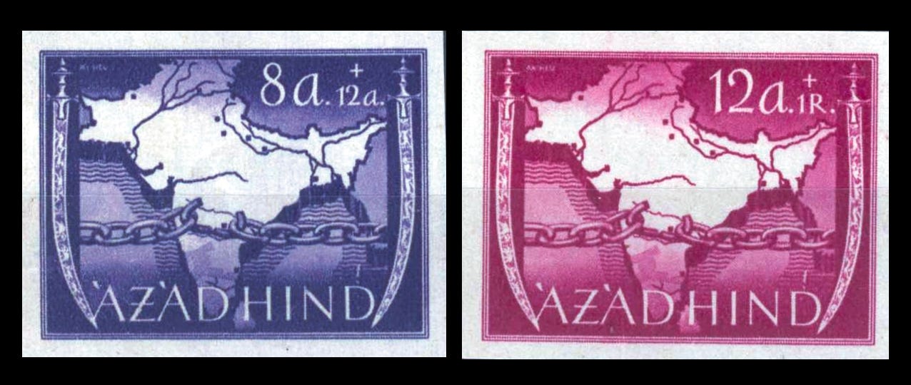
A boy in Hyde Park in the 1890s wouldn’t see much of Bechuanaland, but he could hold up a stamp, leaf through an atlas, and find out all he needed to know about the world, one gummed inch square at a time. As an adult, FDR had a hand in designing some stamps himself, and there were eventually something over a million stamps in his own collection. He would, there is no doubt, have had pristine issues of a 5-cent blue stamp, issued by the US Post Office in July 1942 on the anniversary of Chinese resistance to Japan: a map of China in the centre, Lincoln on one side, Sun Yat-sen on the other. He would likely have wanted the stamps commissioned in 1943 by Subhas Chandra Bose ~ printed in Berlin for the Azad Hind government, showing broken chains in front of a map of British India ~ but that series was never officially issued.
Whether a little Latvian 5-kapeikas found its way into FDR’s stamp collection, I have no idea. If it did, then I hope he turned it over.
MAPS ON THE FRONT, STAMPS ON THE BACK
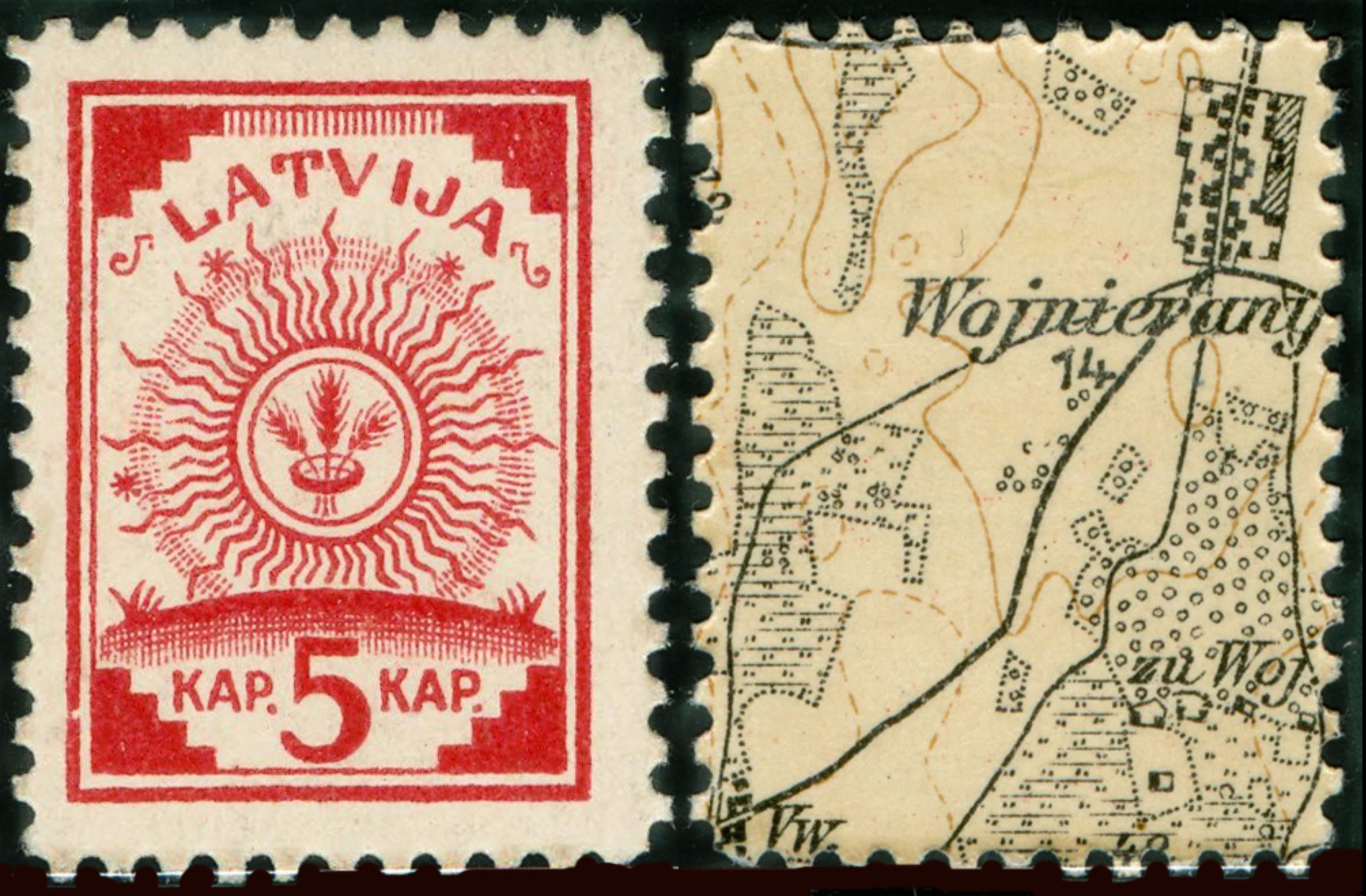
Latvia declared its independence on 18 November 1918, one week after the Armistice. German troops were still in the country and didn’t really leave until late December: the Red Army was also coming the other way, which meant Latvia had to get its act together rapidly. A new state needs a great many things in a hurry and, strangely, stamps are near the top of the list. A nation that can stamp its own voice and carry it clearly ~ collecting revenue along the way ~ is plainly a country that’s doing business. What Latvia didn’t have was paper. What it did have was a warehouse in Riga, chock full of German military maps. Voilà: the maps. Look closely. You can see the stamps, printed on the reverse.
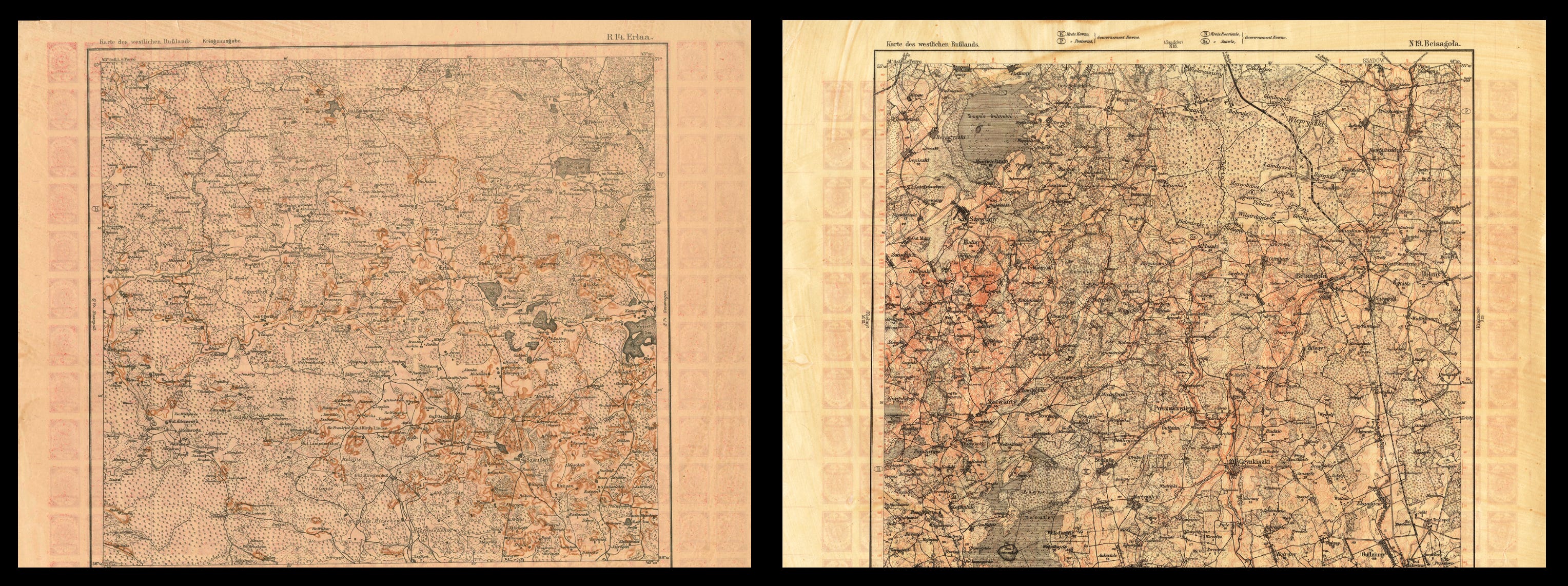
Riga had been the German headquarters for the region, and the map stocks ~ a 1:100,000 series of western Russia, the Karte des westlichen Russlands ~ had been printed to provide some insight as to what lay in southern and eastern Latvia, and most of Lithuania. The map sheets were unfinished. The map side was printed, but the back was blank, and the paper had not as yet been folded. Good paper. Plenty of it, used on one side only. Which is why the Latvian government, in its wisdom, promptly sent it to a commercial printer ~ Schnakenburg’s.
In their print works, stamps were then printed on to the blank side of that mapping, 19 across and 12 down, 228 to a sheet; using as much of each map as possible. Turn any stamp over, and you’ll find a tiny scrap of a German map, brown and black on cream, upside down relative to the stamp. At 1:100,000, that piece of paper holds a reasonable amount of detail: a road, a railway, a patch of wood and the blocks of a farmstead. A few sat in the margins and show very little, which collectors find either a disappointment or a prize, depending on their view.
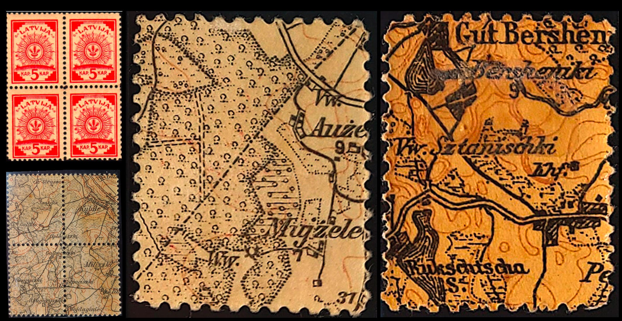
Receipts survive for 11,956 map sheets ~ sorry, sheets of gummed stamps ~ about half of which were perforated and half were not. That’s 2,725,968 stamps by my reckoning. Enough, you might think, to send good news a long way for a reasonable amount of time: the first sheets reached the main post office in Riga on 17 December and went on sale the next day. Unfortunately, early January 1919 is when the trouble began. On 2 January the Latvian government left Riga, and the next day Soviet Latvian troops marched in ~ which means a map-stamp used in Riga belongs to a window of about a fortnight. The government fell back to Jelgava and Liepāja, and didn’t return until 22 May ~ by which time printers were also hauling pallets of cigarette paper into their works, with unfinished banknotes to follow. But that’s not the most interesting thing about these stamps, not to me, anyway.
WHAT’S ON THE BACK
Look closely at the maps on which this postage was produced ~ very closely ~ and you’ll see that the longitudes look wrong. Western Latvia is marked at about 39 degrees east, when any modern map puts it a little over 21.
That ~ I think ~ is because they were being measured not from Greenwich, but from Ferro, El Hierro, the westernmost of the Canary Islands. In short, it looks as though the Kaiser’s army was finding its way around the Baltic by calculating its starting point from an island off the coast of Africa. That didn’t hold them up. Ferro’s meridian was an old one, going back to Ptolemy in the second century. The Kartographische Abteilung der Königlich Preußischen Landesaufnahme ~ the Royal Prussian Land Survey ~ had compiled the series between about 1897 and 1921 from Russian and Austrian military maps, and was still counting from that old meridian long after common opinion had agreed that Greenwich was a better option, in 1884.
STAMPED: THEN, AND THEN, AND NOW
Twenty-odd years after the map-stamp-maps surfaced, the Soviets took Latvia in June 1940. The Wehrmacht arrived in 1941, and new German mapping for the same ground was made. Finished, folded, and issued to all and sundry. I do not, as yet, know if any older officers working on that mapping had ever seen a Latvian 5-kapeikas stamp.
I can prove that British mapmakers were using the French postal system to make sure their stock reached the frontlines in the early part of 1940.
But that’s a story for another day.
Regarding maps printed on strange objects, I just remembered iconic, old Soviet cigarettes, “Belomorkanal” (the White Sea Canal). There was even an associated joke:
A Soviet plane got lost at night, no navigation was working. The pilot asked the co-pilot: do you have your Belomorcanal pack? The co-pilot said: yes I do. The pilot’s responded: good, we will find our way home.