
ISLANDS OF REALISATION
Standing on the quayside in Symi harbour – ice-cream in one hand, squinting at the map sheet that’s flapping in the other – the town itself stands beside you, above you, and behind you. Terracotta façades; burnt-sand pediments; bright-white stucco walls, and hints of periwinkle blue paint – stackable, triangle-topped houses that clutter the harbour’s amphitheatre in tiers; Gialos, the buildings at ground level, Chorio the village above it, and behind them both, the island simply rises up, and up, and up.
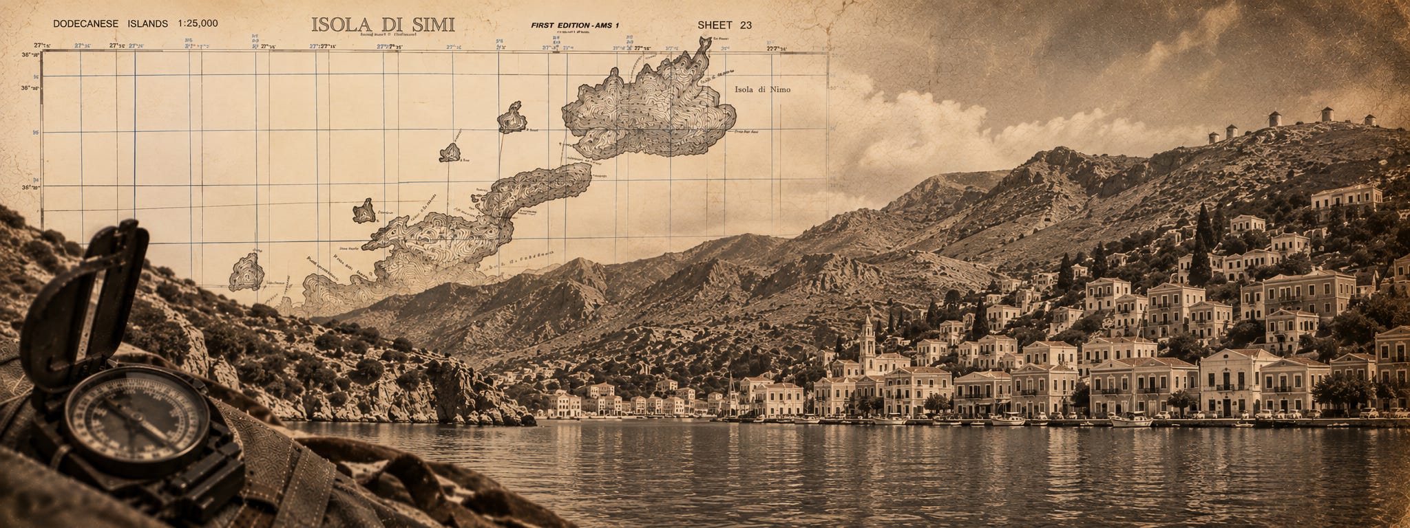
The map sheet – AMS M801: Sheet 23, ‘Isola di Simi’, 1:25,000, first printed by the US Army Map – is awesome. One piece of paper shows everything you need to see on Symi: the paperclip-curves of deep-water harbours; tracks across the island, chapels here and there; and terrain tamed in ten-metre contours – it is an unusually good map, both for the time and for a small Aegean island. It explains, quite accurately, that the ground here rises. It does absolutely nothing to prepare you for how.
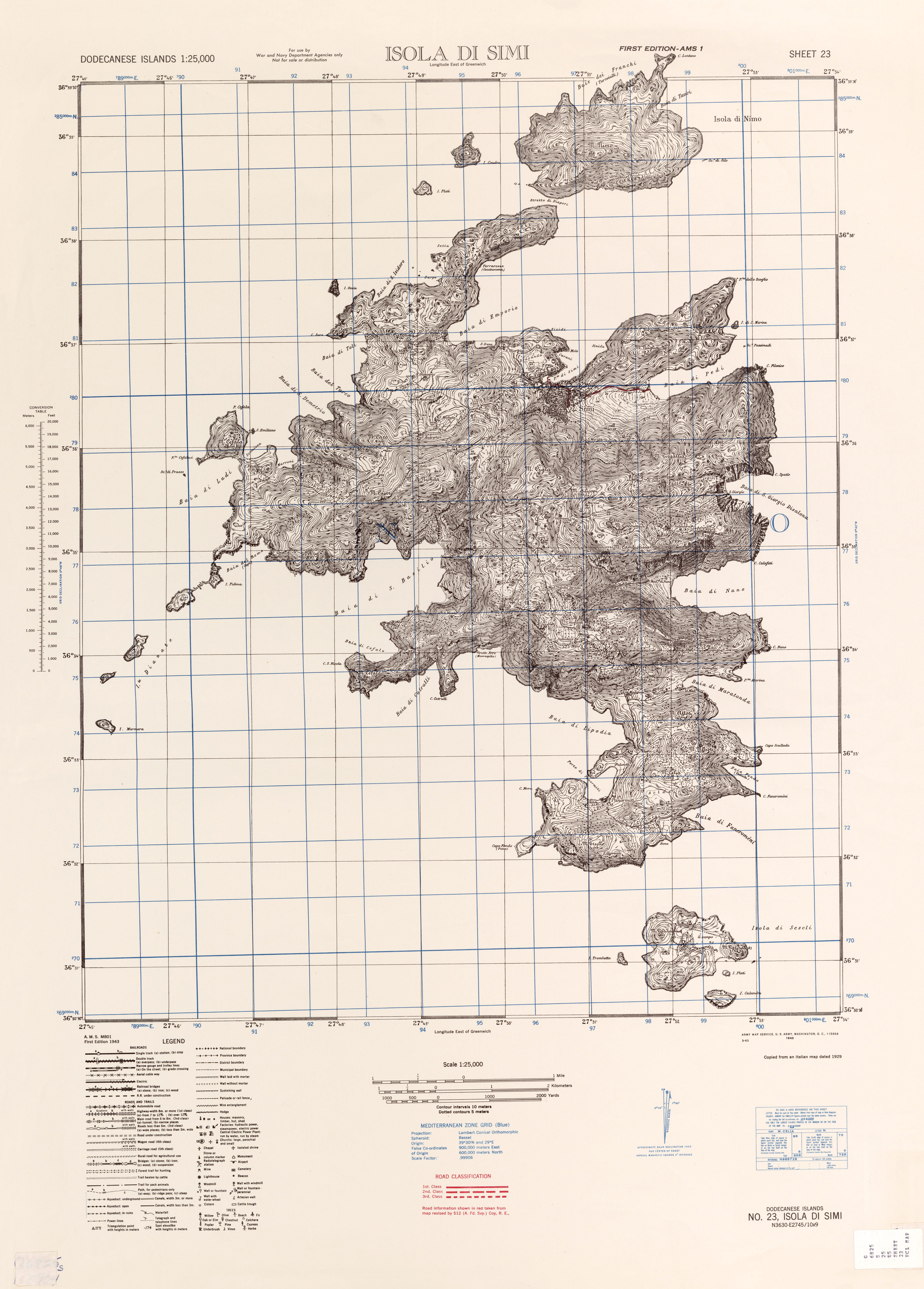
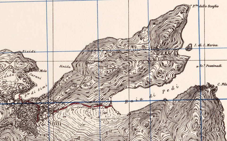
On the ground, and on the map, the town of Symi is divided from the village of Pedi by a ridge-line. That sloping ground hides one from the other: the road between them does not look troublesome. Red-inked and wriggle-free, it rises modestly and then switches back on itself, almost apologetically; accommodating the contours that give one part of Symi town the nickname ‘Alaska’ – the sun caresses houses briefly on one side – and lets ‘San Francisco’, opposite, bask in a searing, day-long light. In fact, Pedi itself is barely a mile away as the crow flies. But then you look up, and realise even Greek crows might think twice about flying there directly.
It is a surreal situation. Holding a map of Symi in your hands, and understanding how to travel around this island and fight to defend it, are two very different things.
The island’s interior has arranged itself like a crumpled pile of washing thrown down in haste by Greek gods. Gullies appear where the map suggests slopes. Paths look like shortcuts but become climbs over loose shale; heat alters distance, and even that relatively new tarmac road – one of the better stretches of road-surface here – has to find its way across a ridge that has no interest in making movement convenient.
I visited Symi partly because my brother has a mind to move there – who knew,, Big Sisters who’ve lived abroad might have views on that kind of life-changing event – and partly because of this map. Produced in 1943, the entire Dodecanese series at 1:25,000 was based on Italian mapping made in 1929, with its roads revised by 512 Army Field Survey Company, Royal Engineers – mainly from air-reconnaissance, mainly done by bombers with little training in flying straight and level repeatedly with specialist, cameras. That said, it is a good map. But again, its contours don’t tell the whole story.
As soon as you consider going from one side of Symi to the other, you face a problem. For centuries, the easiest way to make that journey has been to sail around the island. In September 1943, a small group of British soldiers faced the same problem in far less agreeable circumstances – and without the benefit of ice cream and water-taxis. Those men had access to this same map. What they needed, was knowledge of the ground.
WHAT IS WHERE
Lying to the north-west of Rhodes, Symi is a 66 square kilometre barnacle, with its highest point – Vigla, meaning ‘lookout’ in Greek – at 617 metres above sea-level. The interior is dominated by steep-sided, rigor-mortis-grey limestone reaches; the coast is broken by nip-tuck bays and jagged coves; and land-lights on the Turkish headland are visible at dusk – your roaming charges get argued at a later date.
If you believe Homer, then Agamemnon’s fleet included three ships that sailed from Symi to besiege Troy. The island prospered under treaties that guaranteed its sponge fishing and boat building industries, limiting taxation. By the 19th century it was one of the wealthiest sea ports in the Mediterranean – at its peak, some 500 ships vied for moorings, and the population was supposedly in excess of 20,000, leaving improbable grandeur all around the harbour. Today’s tourists can still buy those sponges – though, much like the island’s fridge-magnets, it does pay not to heed the packaging for local authentiticy. Ottoman rule was followed in 1912 by Italian occupation, and that control was formalised after the First World War. By 1943, Symi had suffered three decades of imported pasta. Then, on 8 September, Italy changed sides.


Armistice turned the Dodecanese into a scramble for regional, strategic dominance. The airfields and large Italian garrison on Rhodes made it the greatest prize, and that island quickly fell under German control, but Symi was just as valuable.
It offered a stepping stone to Kos and Leros – and these were places Germany could not simply write off: it desperately wanted to secure them, before Britain could set up bases. Accordignly, after that armistice, Hitler’s orders were to hold what remained and retake what was lost: to keep neutral Turkey from tilting towards the Allies, and protect what functioned as a very useful supply route into the Balkans. Symi was a very small piece of a very large anxiety, well worth the fight.
WHO’S WHO
On the Allies’ side, it’s useful to be define who we’re talking about in 1943, otherwise, every caïque – every wooden-hulled boat – in the harbour looks as though it’s manned by the same men. A trawl online shows several confusions of operations, and books exploring this history are few and far between – I’ve listed them, below.
The Special Boat Squadron – the SBS – was British, formed partly from SAS and Small Scale Raiding Force personnel. The Greek Sacred Band, or Sacred Squadron, was a separate force under Colonel Christodoulos Tsigantes, Greek-manned and British-trained. The Levant Schooner Flotilla was principally a Royal Navy body, running armed caïques and local schooners to carry raiders, agents and supplies between the islands and the Turkish coast. By April 1944 those three maritime threads – LSF, SBS and Sacred Squadron – had been drawn together under one name, the Anglo-Hellenic Schooner Flotilla. It’s an organisational story, in other words, not four names for the same handful of boats. The fourth outfit, the Long Range Desert Group, also indulged in various bits of active island-hopping – we’ll get to them in Part II.
On 17 September, Major Ian ‘Jock’ Lapraik arrived on Symi with M Squadron, SBS. Twenty-six men, who promptly mounted a captured 20-mm Breda cannon on the ridge dividing Symi Town and Pedi village, and set themselves to better-organising the island’s defences in general. The Italian garrison numbered some 140 men, whose relationship with the Greek population was understandably strained after thirty-one years of occupation. Pasta isn’t that popular, here.
Lt. Commander Corrado Corradini had arrived from Rhodes to help pour olive oil on troubled waters, and rag-tag stragglers fleeing from Rhodes appeared from time to time, to swell the numbers further. But further reinforcements arrived by accident as much as design: intercepting a French sloop bound for newly invaded Kos, Lapraik diverted forty RAF ground crew of 74 Squadron onto Symi instead.
There was no doubt, Lapraik said, the island would shortly be attacked. It was only a question of when: his first Order of the Day to those men compared Symi’s position to Singapore, just before the Japanese arrived. Everyone had to be ‘on the job, all the time’, and men who’d trained to service aircraft became infantry, serving the SBS.
Patrols were the next thing. Every man set to learning Symi at ground level rather than merely seeing it on a map: taking routes over ridges to gauge distance through time-travelled, testing observation points, and assessing the many coves and beaches to work out which were landing places, and which were killing grounds.
That transition is easy to overlook. The SBS were raiders, navigating with charts that had been in circulation for decades to operate on ground that had only recently been drawn accurately, on a map.
In other words, men had to discover what contours meant in reality – but Germany was also deciphering the Dodecanese. Kos had fallen at the beginning of October, too quickly, too easily, and too close for comfort. The strategy in Berlin shifted towards offensive operations, with more of the islands earmarked for occupation, and – with admirable logic – by deciding it might be helpful to have radio stations on Naxos and Symi to support them. What German intelligence hadn’t quite grasped was that the SBS had beaten them to it.
PEDI, PEDANTIC
The Germans came for the island of Symi at dawn on 7 October. On the true size of that landing force, historians disagree with all the veracity of Doolittle’s double-headed llamas, all certain they’re heading in the right direction: German records put it at around 40 men in two caïques and a schooner; some British accounts have it as a 100 men; Thomas Harder has done an in-depth study of Anders Lassen – on Symi with Lapraik – and is confident, 59 Germans came ashore in Pedi bay in a caique, the Esperia, under one First Lieutenant Fresemann.
Pedi bay is an amphitheatre, wrapping its arms around a stutter of shuttered houses at ground level. Symi town lies to the west, its terraces rising steeply from the shore to the south of the harbour – up to a church and citadel. Any force landing at Pedi has entered its own, private theatre – overlooked from the stalls – and there sit the tragi-comedians that provide one of the classic ‘really?!’ moments in this little corner of the war. Gavin Mortimer tells it best. I’ll paraphrase:
When Andy Lassen woke at first light he looked down at Pedi bay, spotting uninvited guests. ‘Who the hell are they?’ he roared, to which the aircrew, standing guard, replied: ‘Well, they’ve just sort of landed’.
The RAF’s version of events was sanguine in admitting that Flight Sergeant Charlie Schofield, manning the Breda cannon, ‘wore spectacles on account of his short sight’. For his own part, Schofield insisted that the German landing party had been engaged the moment they hove into view – and yet somehow, 40 men managed to disembark and start moving inland towards Symi town, totally unshot-at.
As one SBS patrol moved to counter them, it came under fire from a German machine gun that had already found a vantage point above the houses; the Germans were quick to discover what anyone who visits Symi soon realises: a few metres of height dominates an astonishing amount of ground.
Back at Pedi, Schofield tried to keep the remaining Germans pinned down just off the beach: three Stukas had appeared, coming in low – which caused him to laugh, and reassure his comrades that their angle of approach was far too tight to be useful, and their hilltop position was safe. That said, by now the Breda cannon’s vibration had shattered his spectacles and the sights had fallen off the overheated weapon – short sighted or not though, he stuck to his guns, literally, and that courage was rewarded with a Military Medal.
Elsewhere, Lassen – already suffering a burn to his leg and dysentery – was on his way to a second bar for his Military Cross. He led an Italian counterattack that drove the remaining Germans back to their boats, and his citation claims 16 Germans killed, 35 wounded and seven captured, against one British dead and one wounded. That probably overstates the German toll. Some accounts put it nearer two dead, several badly wounded, and nine missing. What everyone agrees on though, is the shape of the day: a German withdrawal under fire, heads down as Lapraik sent an SBS caïque out to rake them, rounding the headland.
It was terrain, as much as anything, that scuppered their plans – the ridge obscuring Pedi village from Symi town had also hidden British positions from the sea, and men who’d spent weeks walking that ground had been in a position to use it as men who’d only glanced at a map could not. It was an impressive defensive success. But it was also temporary – the next day, more Stukas arrived. This time, not flying quite so low.


BOMBED OUT
General Ulrich Kleemann, commanding German forces in the Aegean, sent Stukas over Symi at nine the next morning, returning at two-hourly intervals for the rest of the day. Lance-Corporal Robert McKendrick of the SBS was killed; roughly two dozen Greek civilians died in the town; a direct hit on Lapraik’s headquarters brought down its makeshift hospital, trapping two SBS men, Tom Bishop and Sydney Greaves, beneath the rubble. In a short, grim episode that’s left a mark with everyone who’s written about that week, Ferris – suspended upside down into the wreckage, with little more than a scalpel and a pair of scissors – amputated Bishop’s trapped foot to free him. Both men died; Greaves under the debris, Bishop shortly after from shock and blast. For what they did that day, Ferris was awarded the Military Cross; the American medic, Porter Jarrell, received the George Medal.
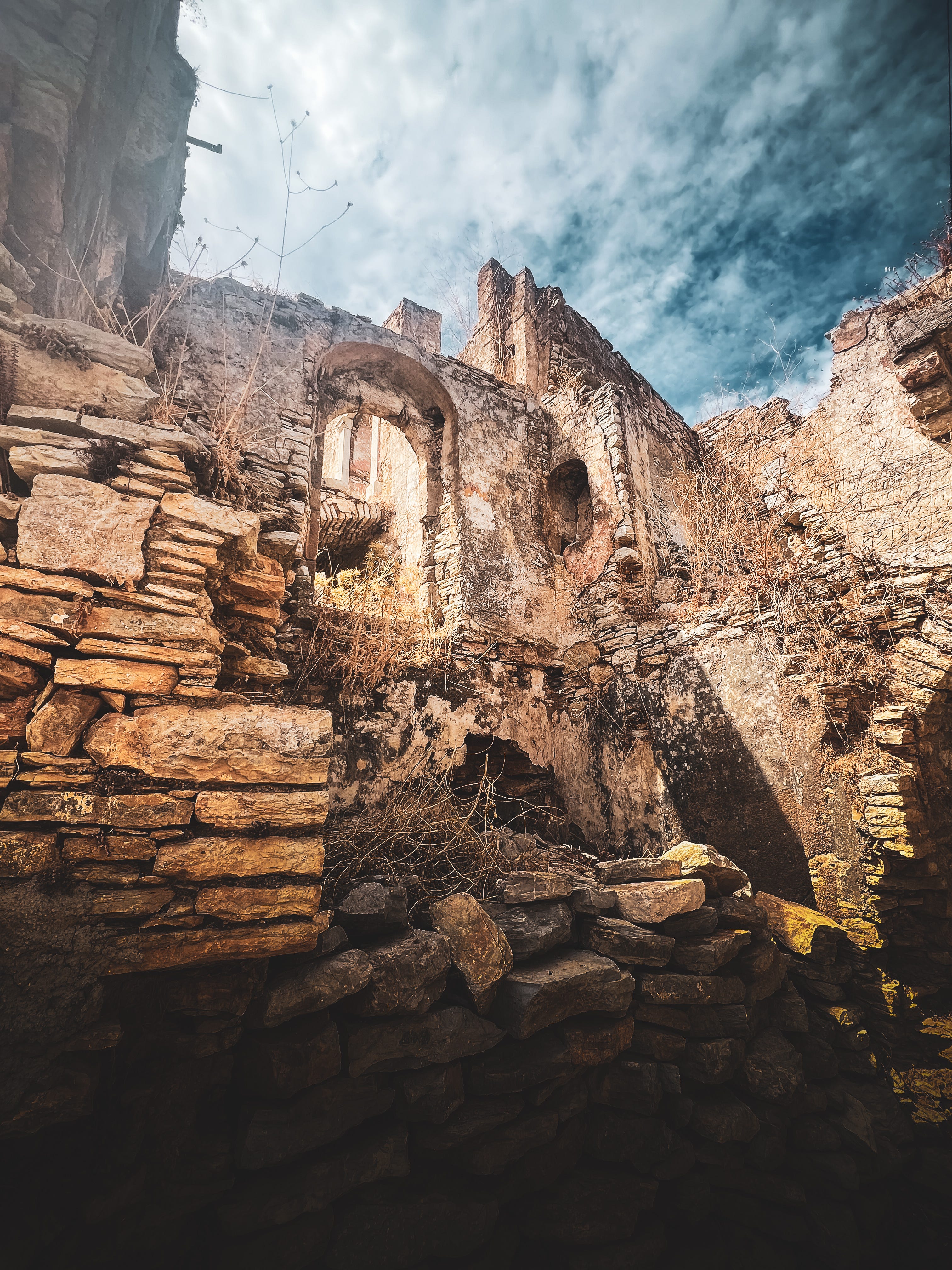
The British could fight Germans in Pedi bay, and into Symi town, but they could little about Stukas strafing the island. A large number of houses were destroyed: their footings remain in the same, Luftwaffe-heavy condition now – several have recently attracted hopeful FOR SALE boards – and many civilians were killed. Lapraik finally withdrew what remained of his force on 12 October. Without adequate air cover, Britain’s position in the Dodecanese was increasingly precarious – and it wasn’t long before the Germans occupied Symi proper.
Nine months later, on the night of 13–14 July 1944, British and Greek special forces returned in strength. This was Operation TENEMENT: a force that crossed to Symi from the Turkish coast in launches, schooners and caïques, dividing into groups and coming ashore under darkness. 100 or so men of the SBS under Lapraik, with 224 men of Tsigantes’s Greek Sacred Squadron. By then Symi was no longer simply a shape on a map. British and Greek forces had spent months moving among the islands, turning contour-lines into recognisable waypoints. The men moved towards their objectives, the harbour defences and fortified ground above Symi town – climbing to positions from which they could dominate German and Italian posts below.
At dawn, mortars and machine guns opened fire; fighting spread around the harbour and through the terraced heights; by the time the force withdrew, twenty-one enemy troops had been reported killed and 151 prisoners taken, while vessels, weapons and installations had been destroyed. TENEMENT had no intention of holding Symi. Its aim was for men to overwhelm the garrison, destroy what they could, and disappear – which they did, with aplomb.
In 1943 and ‘44, SBS had relatively recent mapping of Symi to hand, and there’s no reason to diminish those map sheets’ quality to make the point that only took me only seconds to realise – ice cream purchased – stepping off the ferry last week.
The official wartime history of British military survey shows how uneven the region’s mapping inheritance had been to date. It’s true, GSGS had prepared some mapping of mainland Greece at 1:250,000 and 1:100,000 by gathering information from the Greek geographical service. Symi makes for an intriguing contrast. The excellent 1:25,000 map sheet was ultimately derived from Italian surveys – precisely the kind of large-scale mapping its military geographical service could deliver par excellence. It records the island’s interior accurately, though it cannot communicate the steepness under your legs, the dead ground your eyes find for themselves, the way heat rearranges distance, the way loose rock slows you down, and the precise way in which a single ridge can hide an entire village and harbour from a town, just a mile away.
A good military map had reduced a violently three-dimensional island into something that could be folded, copied and planned over, but the SBS and the Sacred Band still had to discover, on foot, what tidy contour lines actually meant. But there is another part to this story, one that takes us away from Pedi village and Symi town – and the knee-punishing Kali Strata; 385 polished, pine-resin-covered stone steps – over to the south-west of the island.
On the same 1:25,000 map I held last week, those painstakingly-drawn contours depict a magnificent, enclosed bay. At its head, sits the monastery of the Archangel Michael at Panormitis – a seat of prayer, crucial to the struggle for insight, observation and control of the Aegean. That is where Part II will begin.
In the meantime, this is a must-have if not exclusive list of bedtime reading:
On the SBS and the Aegean raiding forces
Gavin Mortimer, The SBS in World War II: An Illustrated History — an excellent tome, a great overview of the region’s campaigns, superbly illustrated, and useful for keeping the wider SBS chronology straight around the Symi episodes.
John Lodwick, The Filibusters: The Story of the Special Boat Service, reissued as Raiders from the Sea: The Story of the Special Boat Service in WWII — the first official history of the SBS, written by a man who served in the Aegean himself. Feels dated now, but it’s useful and timely; written in 1947.
Nicholas Jellicoe, George Jellicoe: SAS and SBS Commander — a biography of the man who actually ran Raiding Forces HQ and the Aegean operations that Lassen’s detachments answered to. Useful for the command-level view above Symi itself.
On Anders Lassen himself
Thomas Harder, Special Forces Hero: Anders Lassen VC MC — a rich biography of the man, well worth tracking down.
Mike Langley, Anders Lassen VC, MC, of the SAS — a biography drawn substantially from the testimony of the men who served alongside him.
On Symi, on the Sacred Squadron, and Levant Schooner Flotilla
Adrian Seligman, War in the Islands: Undercover Operations in the Aegean 1942–4, Recalled by Men of the Levant Schooner Flotilla, the Greek Sacred Company and Aegean Raiding Forces — possible the best-targeted book for this region. Seligman ran the Levant Schooner Flotilla that ferried raiders like Lassen’s men between islands including Symi, and this book is built from first-hand accounts.
W. E. Benyon-Tinker, Dust Upon the Sea (Hodder & Stoughton, 1947) — is the better single book for the flotilla. Benyon-Tinker was the flotilla’s intelligence and gunnery officer, and this a contemporary memoir of the operations, written just after the war,. It’s out of print — and no, I’m not lending you my copy.
Anastasios G. Vlachostathopoulos, Ieros Lochos 1942–1945 — is in Greek.
Academic bits and pieces
There’s a Naval Postgraduate School thesis, Amphibious and Special Operations in the Aegean Sea 1943–1945, that’s downloadable from various repositories. There’s also a shorter academic paper specifically titled The Sacred Squadron, on the Greek unit’s Aegean service, that’s on Academia.edu — which has become a tad unwieldy.
On the wider Dodecanese campaign
Anthony Rogers, Kos and Leros 1943: The German Conquest of the Dodecanese (Osprey Campaign series) — is focused on Kos and Leros rather than Symi, but it’s useful for the operational framework inside with the Symi raids sit. Keep your eyes open for Anthony’s forthcoming book via Osprey books in 2027, The Long Range Desert Group: Italy, Greece and the Balkans, 1944–1945.