
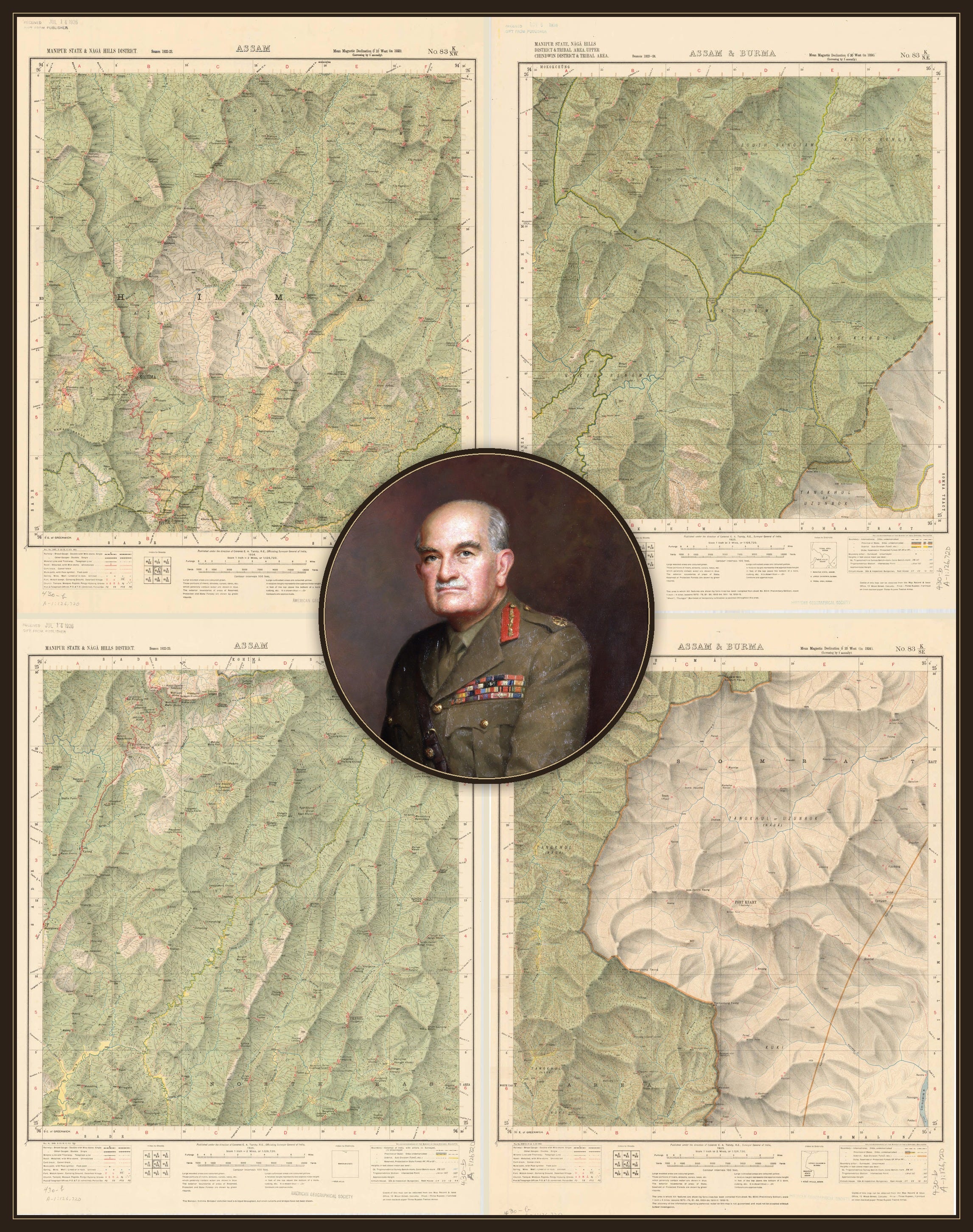
The most memorable comment on maps in the Burma campaign, has to be the wise words of Field-Marshal Sir William Slim. Writing in his 1959 book Unofficial History, he reflected that battles always seemed to happen “in the dark, uphill, in the rain, and at a spot that was inevitably at the corner of four separate map-sheets.”
It’s good, because it’s true. Anyone who’s tried to read a map in bad weather under fire will recognise it: someone has the wrong map, someone else has the right one but they’re at least fifty feet away, and the place that matters most is probably not on that map anyway, but the next map along. Yet while it’s a soldier’s observation, it’s also an odd thing for Slim — in particular — to have said.
Here was a man with a reputation as one of the most practical, unpretentious generals Britain had produced to date — famous for wanting to know how a road was built or a ration-lorry loaded, not just whether it turned up on time. But the only thing he said about maps, was disparaging. It’s a familiar habit of mind though, and not really his fault: people who read maps rarely ask how they were made. Even, it turns out, the people whose job it is to read them for a living.
Unofficial History is what it says on the tin — a set of after-dinner reflections, told at a comfortable distance from the paperwork, in the voice of a man entertaining a room rather than compiling a report. Very quickly, we get the idea that mapping in Burma was thin at best, and inconvenient at worst. Mention maps and the Far East today, and it won’t be long before someone volunteers more or less exactly that: the impression of a remote country, dense jungle — and presumably terrible maps. It has settled into the footnotes of history as something nobody bothers to check. Which is annoying.
Recently, I was asked for a specific map sheet: Survey of India 83 K/8, one inch to the mile, covering the country around Shangshak, east of Imphal. Sadly, I knew I didn’t have it, not a copy I could share — and more to the point, I didn’t have anything else from that K-block either, not a a decent scale. For reference, here’s Shangshak:
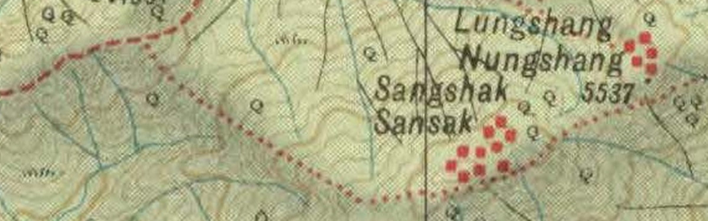
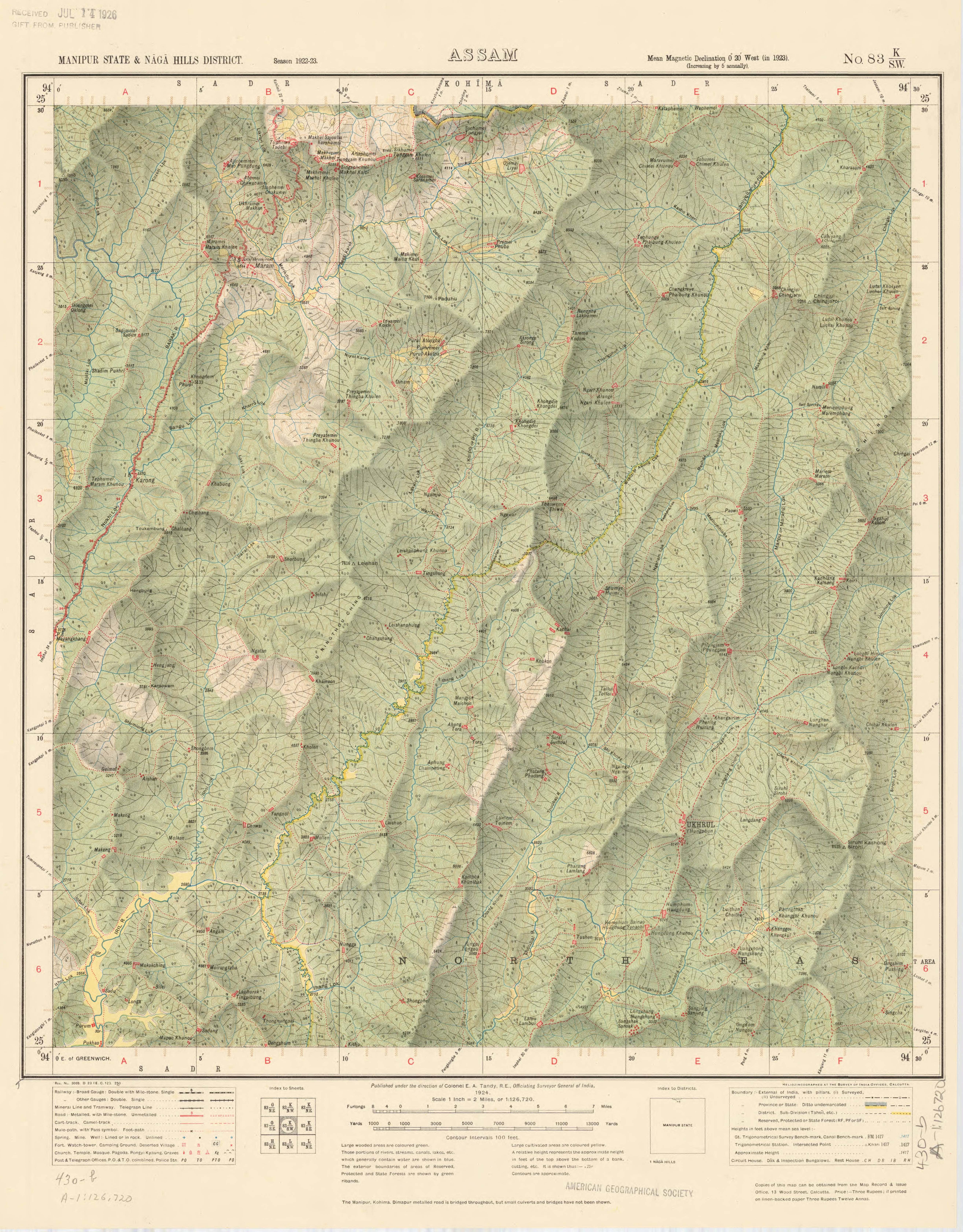
At this scale — one inch to two miles — it doesn’t inspire confidence. There’s a lot of dense green ink, it’s all pretty thick vegetation, and those contours are no joke.
Wartime maps for this theatre have been finding their way into institutional libraries and university collections for the better part of two decades. Searching them, and indeed, searching for them has never been easier: in minutes, a researcher can find material that would once have meant a train fare, a reading-room ticket, and a great deal of patience. What’s missing is a one-inch to the mile sheet for that ground — 83 K/8 — which is four times more detailed.
Same square of earth, much finer print: individual tracks, smaller features, the kind of resolution a battalion digging in on a specific hill would actually want, rather than the wider district view a half-inch sheet gives us.
So what happened there, and where is that mapping?
Shangshak is not obscure ground. It deserves to be better known. In mid-March 1944, the newly raised 50th Indian Parachute Brigade was sent into the hills north-east of Imphal to rest rather than fight. Nobody expected them to meet anything or anyone more serious en route than perhaps a long-range patrol. What they encountered was the leading edge of an entire Japanese division aimed at Kohima: a division that — much like the Spanish Inquisition, as I understand it — nobody had been expecting.
The brigade fell back on Shangshak — a Naga village that happened to command the tracks south-west to Imphal — and dug in as best it could. The ground didn’t allow for much digging: there, they found themselves on the rock of an extinct volcano, too hard for slim pickings, so what passed for trenches were barely scrapes in the topsoil. There was little potable water on the hill, either. Everything had to be carried up from the valley through a ring of Japanese lines that were tightening by the day, and more than one air-drop of supplies drifted down into enemy hands.
For the best part of a week they held on regardless, at a heavy cost, before those few who remained could break out and get to Imphal. Documents recovered later showed how much more of the Japanese force was heading for Kohima — and none of that is really my subject, and there are historians far more erudite than yours-truly who tell that particular story superbly. It’s the maps that interest me, the maps those men held in their hands.
The terrain, and what it took to survey it
The country itself is the place to start. The usual shorthand of jungle, mountains, and ridges is accurate without being remotely explanatory. Open a map of the Naga Hills instead. Ridge follows ridge, each one cutting off the view of the next; the valleys between them twist away almost as soon as they open; there are footpaths and tracks but few roads, and little that behaves like a straight line. A mile — an inch — on a piece of paper might mean a long descent through undergrowth with a bad attitude, a river crossing on a bamboo bridge that a good flood could remove overnight, and an equally punishing climb before the next ridge even comes into view.
But we do know how punishing it was, because this ground had been surveyed, and surveyed relatively well at a smaller scale, only a few years before the war reached it. Luckily for us, at least one of the men involved wrote a first-hand account.
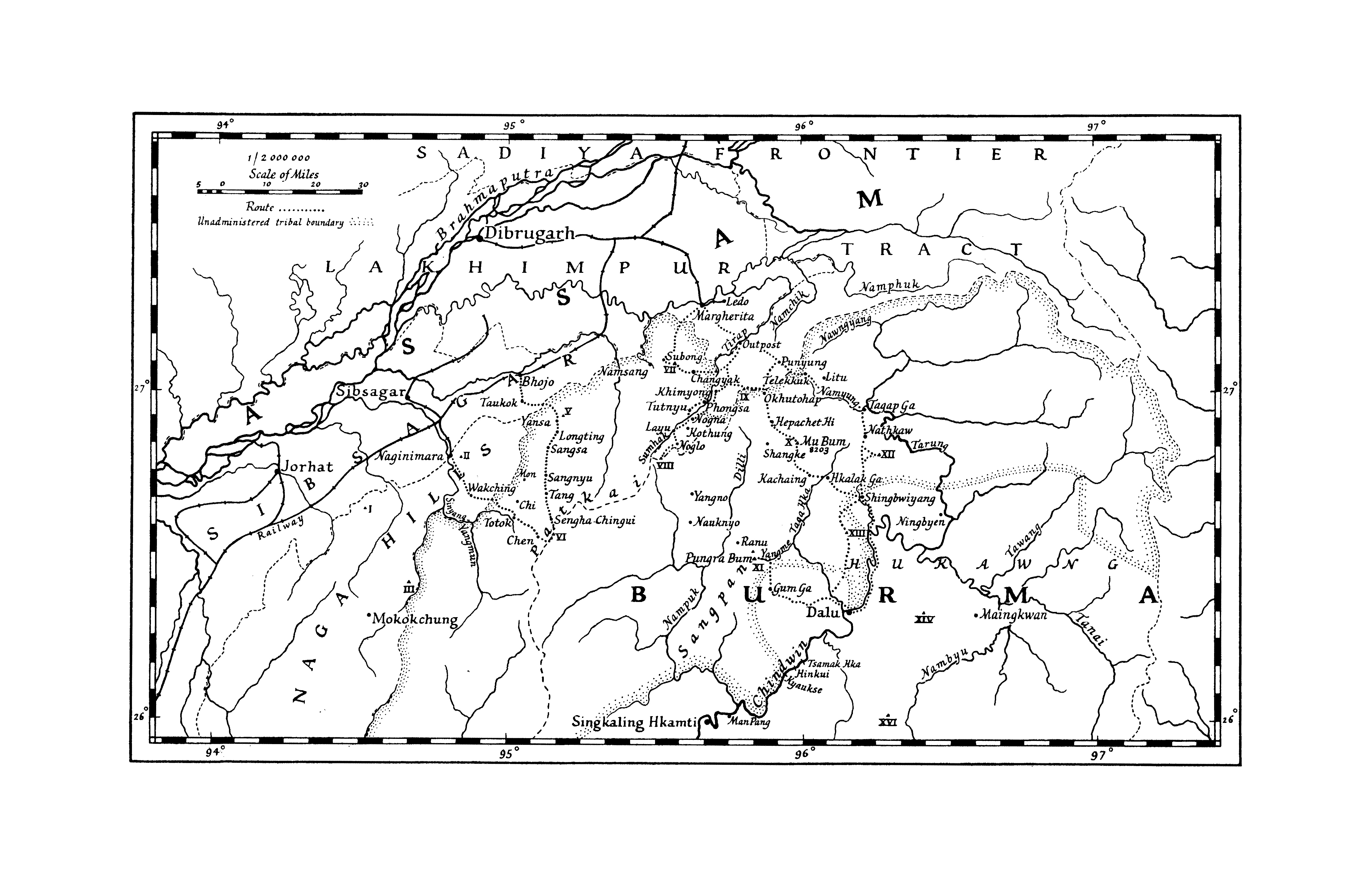
In January 1937, Eric Lambert took the podium at the Royal Geographical Society in London to read a paper on the previous season’s topographic survey work.
In his own words, Lambert was ‘nominally an officer of the Indian Police’ — a humble understatement. He was a sub-divisional colonial officer and, at the time, a magistrate at Mokokchung when the Survey of India decided to send a triangulation party through his patch. The Government of Assam had judged it too dangerous to let surveyors loose in fully independent, tribal territory without a political officer who knew the ground. That meant a man in Lambert’s position had to travel with them, keeping the peace long enough for men with theodolites to do their work. One member of the audience couldn’t resist a good heckle: even in India, apparently, a policeman’s lot was not a happy one.
The whole point of that season’s survey work though, was to connect two existing chains of triangulation — one running up the Brahmaputra through Assam, the other up the Irrawaddy through Burma — by a third series, threading north-east across the Naga Hills, over the Patkai, and down toward the Chindwin. Maps did exist. It’s the scale and the detail of the map, that matters.
Major G. H. Osmaston led that survey party, with Lambert’s escort comprising four platoons of Assam Rifles under one Major L. C. Bull. The country beyond that district answered to no government at all, only to itself. The danger was not theoretical. Paths were seeded with panjis — sharpened bamboo stakes hidden under dead leaves, and almost in passing, Lambert noted that one of the villages was suspected of ‘the cutting up of a previous Survey Party’. That cutting up was literal.
The column moved in strict order — guide, scouts, advance guard, porters, baggage guard, porters again, rear guard — with temporary porters recruited only from the villages that lay ahead in the line of march. That way, there was much less opportunity for anyone to think better of the arrangement and vanish overnight.
Diplomacy was conducted the old-fashioned way: at one river crossing the local chiefs came down to meet the column and were given a bottle of rum and a hank of red wool in exchange for a mithun — a bit like a semi-domesticated small cow; less a working animal like a plough ox; more a wealth and status animal, sacrificed and eaten at feasts, and used as a formal gift to mark a meeting between groups. Owning mithun, and being in a position to give one away, was a marker of prestige. Most exchanges of mithun — including the ones between surveyors and chiefs — were marked by revelry and wild, wide-eyed dancing.
Two hundred Sema Naga porters carried the survey expedition’s stores, topped up as they went with temporary labour, because — as Lambert noted, with the particular deadpan of a man who’d had to solve this problem personally — a single porter would eat his own, entire sixty-pound load within a fortnight if nobody stopped him or resupplied him. Which rather defeated the purpose of sending anybody anywhere.
On one peak, the jungle on the summit was so thick, it took a hundred men three days simply to cut sightlines through it — three days of clearing, before a theodolite could be set up and aimed at anything. Multiply that across several hundred miles of range, in every direction, in a working season that’s bookended by monsoon cloud at one end and the smoke of hillsides burning at the other, and we can start to see why ‘surveyed’ and ‘well mapped’ were not, in this particular region, quite the same claim. None of which is to say the hazards were only physical. After Lambert presented his paper, it’s a safe bet the discussion that followed was a lively one.
During the session at RGS — a ‘this is more of a comment than a question…’ event — Colonel Rich, who’d spent three seasons in the early 1920s surveying the Hukawng valley and Chindwin watershed on the Burma side of the Patkai, noted that his own surveyors had returned with reports of human sacrifice and head-hunters. Rangoon dismissed those first reports as old wives’ tales; a second season’s investigation confirmed they were true, if rare. In one village, Rich’s men found a girl being kept for sacrifice that summer. Rich bought her freedom for £40, and sent her to missionaries at Myitkyina — where, in the detail I’ve found hardest to shake off, she was later given a hospital powder she mistook for poison, and drowned herself in the river rather than take it.
Lambert’s paper touched on the same ground: some of the villages being surveyed, he remarked, buried their dead beneath the household granary, and didn’t seem bothered if ‘buried’ was only ‘partly buried’. A former District Commissioner in the audience went further, noting that cemeteries could not be moved, and any growth in a village’s footprint simply meant that a street became a graveyard, so that walking through a settlement meant passing a run of houses, then a row of corpses old and fresh alike, and then houses again. Nobody was remotely troubled by the arrangement, and none of that detail will be found in any textbook on triangulation. Nor is it in the footnotes of military history. But it is, all the same, part of what a survey party in this country had to contend with on top of the jungle, the rain, the sixty-pound loads, and — once the fighting began — the risk of getting shot.
Lambert closed his presentation with this: “The Naga Hills — a beautiful country and a happy and lovable people. May they long be spared from the terrible consequences of Western Civilization.” Not, on the face of it, the sentiment you’d expect from a man who’d just spent a season helping the Government of India draw lines across those hills. But it’s a useful reminder, the people doing this work were rarely as simple as ‘surveyor’ or ‘policeman’ suggests. The maps resulting from those survey parties were never just academic abstractions — somebody had to dance for that mithun.
How the Army was supplied with maps
The organisation conducting those early surveys was not, in peacetime, a military affair. The Survey of India was a civil department, working in Circles — Shillong for Assam, independent parties for Burma and the south, a Frontier Circle up at Simla for the North-West. Britain had maintained a Geographical Section at the War Office since before the First World War to provide military mapping for its outposts; India had little comparable, no military survey representation at Army Headquarters — and this isn’t the ‘stack to offer a full history of the Survey of India.
Nor is it the place to set out the entire transition from civil affair to military shenanigins during the Second World War. Time, space, et cetera. Suffice it to say, when war reached India’s doorstep in 1942, the mapping units that would eventually supply the Fourteenth Army came into being — and were far from fully prepared.
The organisation was pulled together in a hurry: Survey of India staff transferred onto military establishments; field survey companies raised from scratch — one of which was reconstituted from a unit that had walked out of Burma with little but the clothes it stood up in, its triangulation records abandoned and lost at Myitkyina. Production units were shipped from England in lorries that had been built for European roads, to negotiate mountain passes that had never met a fourteen-ton vehicle before. Ink dried too fast. Paper faded and curled. Various, previously undocumented fungal contagions ate their way into the wooden legs of every piece of precious survey equipment — and that was the least of it.
Still, miracles happened.
Map depots were set up at Ranchi, Barrackpore and Bangalore — and the Barrackpore depot eventually moved into a converted jute mill with enough room to store five million map sheets, which gives some sense of scale.
Distribution ran by rail wherever the mapping could be guarded, and by liaison officer where it couldn’t — unescorted maps travelling into Assam had an unfortunate habit of simply not arriving. For issue to units in the field, closer to the frontlines, sheets were folded in three and bundled 50 at a time; 300 of those bundles filled a sandbag, 1,200 filled a flour sack, and a flour sack of maps weighed a solid 70 or 80 pounds — which is a detail I rather like. Somewhere in Assam in 1943, a fair number of men spent their war grumbling about backache. Maps — stacks of paper — are heavy.
One of the men who understood the whole supply chain, from theodolite to printing press, was Colonel — later Brigadier — Guy Bomford: seconded to the Survey of India in 1921, long before anyone was planning a fighting retreat from Burma, let alone a return to it. Perhaps, if you’d like it, I’ll do a series on people.
Working his way through a predictable career as a military surveyor, Bomford found himself occupied in postings across the Middle East, India, and Burma, and eventually responsible for the whole Eastern Army mapping effort. He later wrote what is, by agreement, one of the best standard English-language textbooks on the discipline of mapmaking — it’s fair to say he knew what he was talking about.
What he set down, in his own account of the Survey Service in situ, is precise rather than dramatic: by 1942, the whole of Burma and eastern and southern India had been surveyed at the 1-inch scale, ‘except for a belt covering the Chin and Naga hills where the ½-inch scale had been adopted’. It’s tempting to read that as a euphemism for ‘not done properly,’ but that’s unfair to the surveyors.
A half-inch sheet covers four times the ground of a one-inch one for the same cost in paper, engraving and — as Lambert’s porters would tell you — unbelievable human effort. In a country governed by ridgelines and passes rather than roads, a wider view arguably serves a commander better than a narrower one. What the coarser scale also tells us, reliably, is where the terrain itself made the finer scale prohibitively expensive. That belt runs directly over Shangshak.
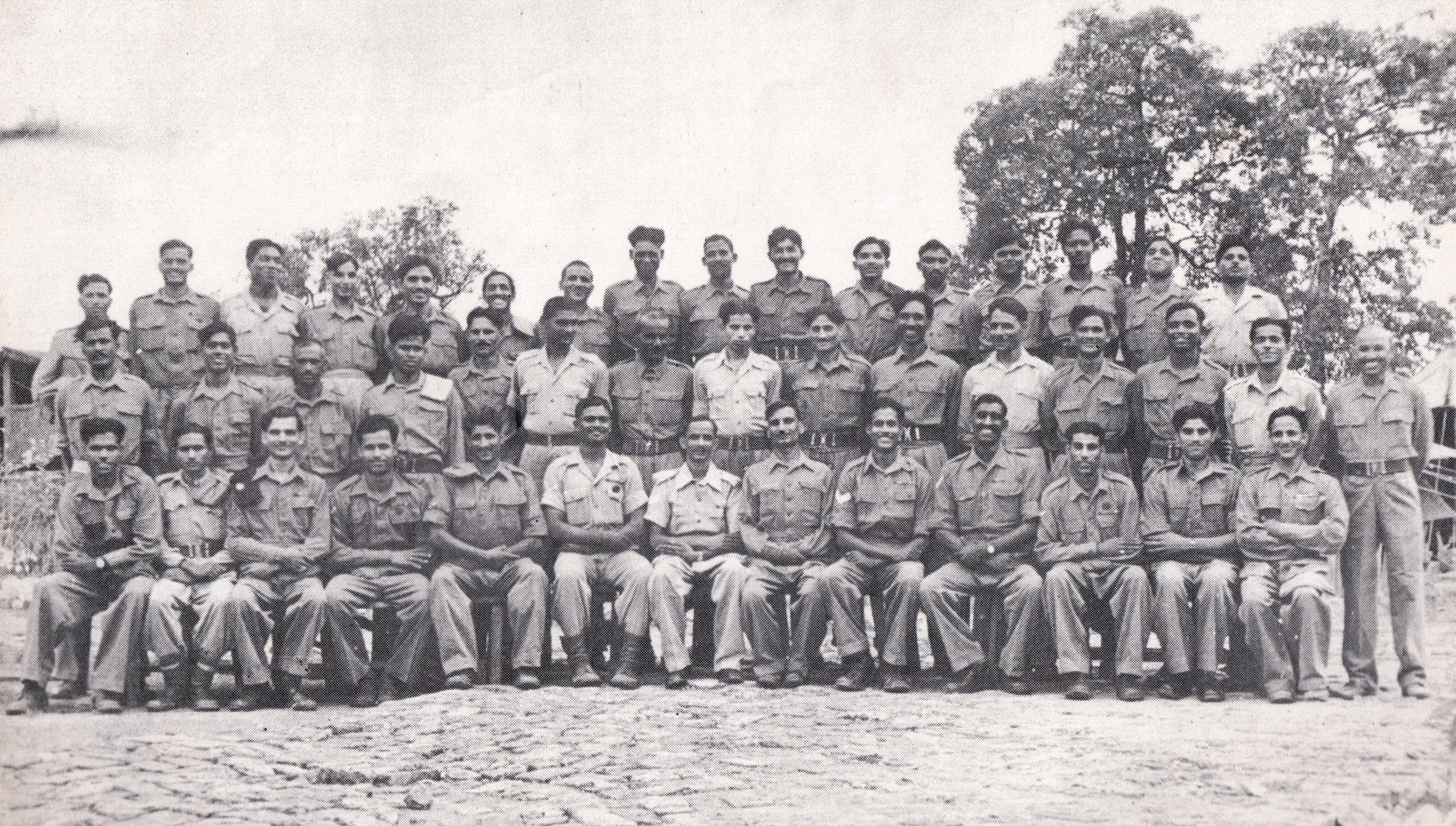
From the summer of 1943, the drawing of any maps in that region fell to 63 (Indian) Reproduction Group, one of the units reinforcing the base production effort that was taking shape at Calcutta — their output for the year specifically includes new quarter-inch and half-inch editions of Arakan, Manipur and the Chin and Naga Hills.
By March 1944 — at about the same time the Japanese reached Shangshak — that effort had shifted. Survey directorate control of the Fourteenth Army had been passed to Eleventh Army Group, and it was now 71 (Indian) Base Map Reproduction Section at Harihar in southern India that formed the backbone of forward map production for the whole Burma campaign, along with air survey units working alongside it.
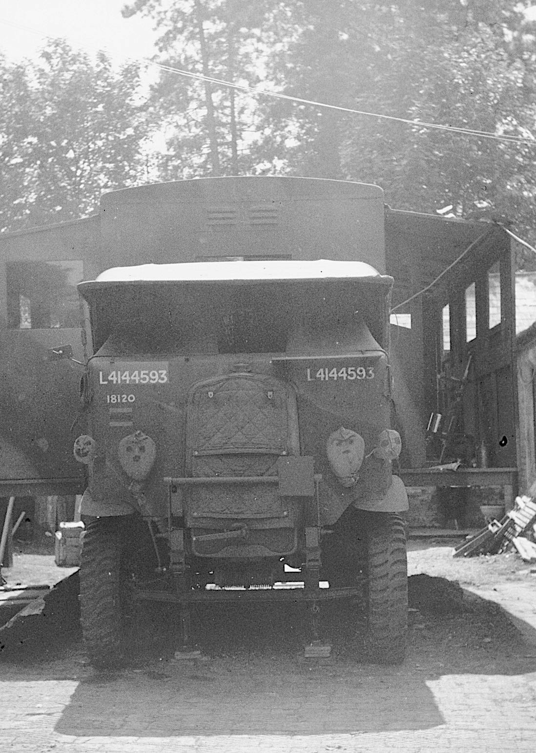
Even so, it was too little too late. While the 50th Indian Parachute Brigade was trying to dig in on a hill with very little water and, as far as I can establish, no good maps either, the unit that spent the rest of the war keeping Fourteenth Army supplied with maps was still getting itself together, several hundred miles to the rear at Harihar.
What’s missing now
Which brings me back to the missing sheet. The digitised Survey of India mapping I keep for reference runs to something like 9,500 — yes, nine and a half thousand — individual maps. One-inch and 50,000-scale sheets covering most of South Asia.
Grid block 83 — the block containing Assam, Manipur and the Naga Hills — is divided into sixteen quarter-blocks, lettered A through P. At the one-inch scale, A through J, L, M and N are all present and correct, several editions deep, running from 1909 into the 1960s. Burma’s neighbouring one-inch sheets, over the Upper Chindwin, are there too. But K — the block that holds Kohima, Shangshak and Ukhrul — is absent. So, for what it’s worth, is O, which sits next door. At the coarser half-inch and quarter-inch scales, both blocks survive: Kohima alone has quarter-inch editions from 1926, 1937, 1943 and 1945 — it’s only at the scale a battalion would actually have carried that this one patch of ground has gone quiet.
That’s no proof, the one-inch 83 K/8 doesn’t exist at that tighter scale. What’s more likely, is the basemap existed, was carried, folded, and refolded until its very substance gave way, and multiple copies didn’t survive the war — which was, for a working military map, the usual fate. Military mapping is paper that’s rarely left lying around — and the mapmakers’ stories, to date, have gone pretty much untold.*
None of that accounts for what’s sitting in private hands. I suspect that’s where the answer lies. Serious students of this campaign — and there are more of them, doing more careful work, than most people outside the field realise — tend to accumulate this kind of material over decades: given by veterans, bought at auction, inherited from a relative who served. Very little is catalogued, let alone digitised. I would be surprised if someone researching Kohima and Shangshak didn’t have an original Sheet 83 K/8, or something close to it, on a shelf somewhere. I keep a certain amount of paper maps myself, in addition to what’s indexed online, for exactly this reason.
Donations turn up, old bundles get re-catalogued, and shoeboxes get passed on. Sheet 83 K/8 may turn up tomorrow, in an archive that hasn’t finished cataloguing this decade’s donations. Or it may genuinely be gone — lost to eighty years of monsoon, mildew, and the happy accident of being merely just another piece of paper that needs filing somewhere. None of that changes the substance of Slim’s joke, which is still one of the best lines to come out of that campaign, and needs no correcting.
Would it have made a difference, having that one-inch sheet in hand?
Probably not. No map, however fine the scale, tells a brigade sent up to rest that a division is coming instead of a patrol, and no map puts water where the ground has decided there isn’t any. What the finer scale might have provided is harder to weigh: a trench line sited a little better on ground that offered almost nothing to work with, a resupply drop that lands inside the perimeter rather than drifting into Japanese hands, a track known in advance rather than found under fire. Shangshak was decided by surprise and by numbers, not by maps. But “wouldn’t have changed the outcome” and “wouldn’t have helped at all” are different claims, and I’m only confident of the first.
Long before four map sheets meet at an inconvenient corner, each one travels through survey parties in unmapped hills, through computing offices and engravers and printing presses, by rail as far as a railway goes and then by road or air or man or pack-mule — a map’s journey is rarely documented in detail. If it does its job well, then nobody doing the fighting ever has cause to think about it. Little wonder, few of us think about the maps, now.
If a stray 83 K/8 is sitting in your attic, I would love to hear about it. As to those untold mapmakers’ stories — well, you’re in the right place for news on that score.
Thanks for reading Mapping History.
Brilliant!
Extraordinary history and an aspect of the CBI campaign that never crossed my mind. To emphasise the importance of military maps a brief story. Years ago I read an account of US Army advisors working with the Republic of Vietnam Army (ARVN). The US advisors experienced great difficulty calling in artillery fire support because the maps they used were hopelessly out of date. It was even claimed that the maps had a zero meridian that went through Paris rather than Greenwich, that might be apocryphal.